In the middle of austral winter, West Antarctica is sending two alarming signals at once. Satellite images show roughly 650,000 km² (250,000 sq miles) of winter sea ice failing to form in the Bellingshausen Sea — an area about the size of France — while Argentina’s Esperanza Base on the Antarctic Peninsula recorded a June high of 15.4°C (59.7°F), shattering the previous monthly record. Scientists say the pairing of open ocean in a region that should be freezing solid, and rain instead of snow at research stations, is consistent with a warming climate — even if every individual mechanism is not yet fully pinned down.
Where the Bellingshausen Sea is
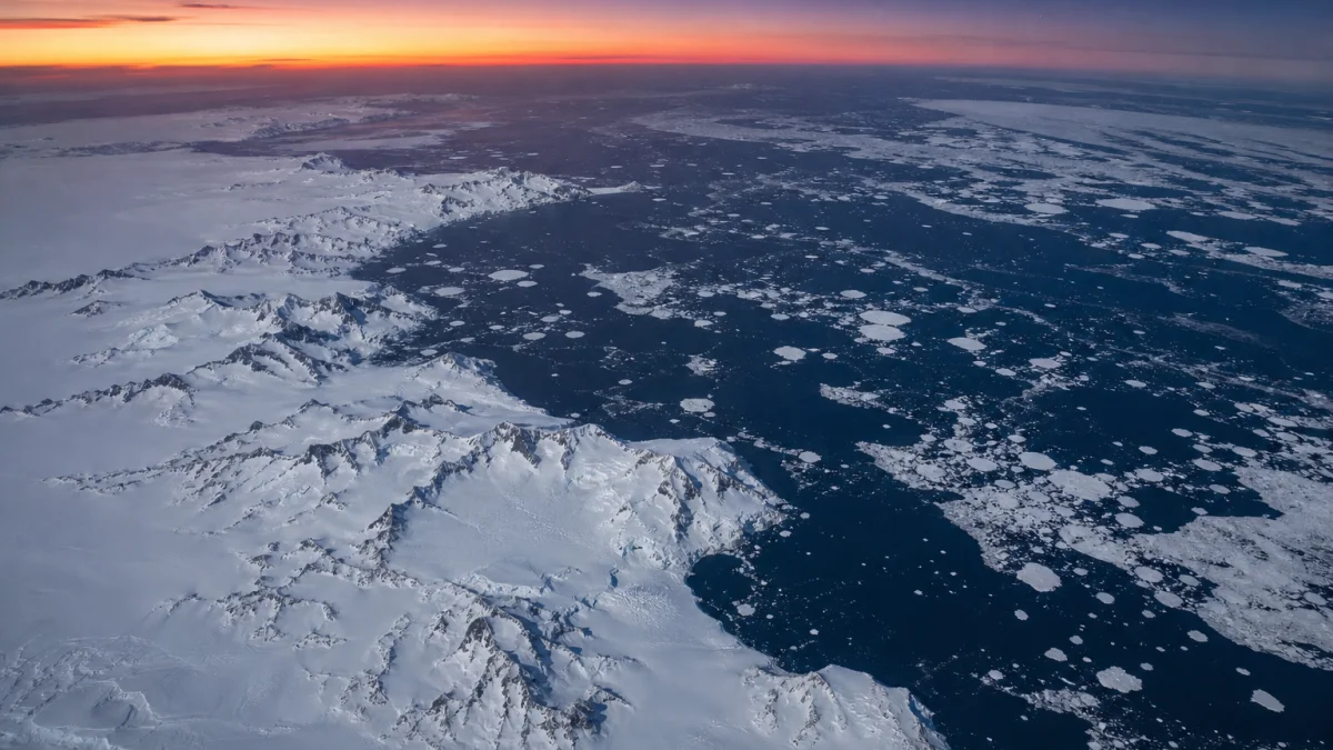
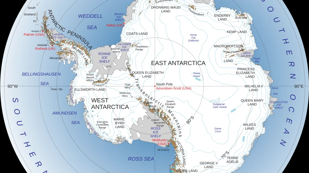
The Bellingshausen Sea sits off the west coast of the Antarctic Peninsula, between the peninsula and the edge of the West Antarctic Ice Sheet. By mid-June, it would normally be covered by expanding winter sea ice as the Southern Hemisphere moves toward its September maximum. Instead, satellite imagery from 11 June 2026 shows the sea largely ice-free while ice grows elsewhere around the continent.
Sea ice researcher Dr Will Hobbs of the University of Tasmania told ABC News that the Bellingshausen is oceanographically unusual: relatively warm water has an unusually close connection with warm currents moving southward, which helps explain why this sector has also seen significant land-ice loss from glaciers and ice shelves. Hobbs has tracked the region daily since April 2026 and said he was not surprised when the winter deficit became clear — adding that ocean conditions may no longer support much local sea ice formation even if some ice drifts in from other sectors later in the season.
Record June temperatures on the peninsula
The temperature spike is not abstract. At Esperanza Base, Argentina’s northernmost Antarctic research station, instruments logged 15.4°C (59.7°F) on 6 June 2026. That breaks the previous June record of 13.3°C (56°F) from 1998 and sits more than 20°C (36°F) above the station’s typical June daily maximum of about -6.2°C (21°F).
Other Argentine bases saw unprecedented warmth on the same weekend:
- Marambio: 11.8°C (53°F), above the prior record of 9.2°C (49°F) and far above a June average near -10.7°C (13°F).
- San Martín: 9.4°C (49°F), surpassing the previous 7.8°C (46°F) record against a June average near -5.6°C (22°F).
Jose Luis Stella of Argentina’s National Meteorological Service told AFP the readings were “very unusual for this time of year.” Esperanza had recorded above-zero temperatures daily for three consecutive weeks, with precipitation falling as rain rather than snow — a pattern British Antarctic Survey scientist Thomas Caton Harrison said creates runoff on bases and stresses penguin colonies adapted to dry, cold conditions. University of Groningen professor Raul Cordero said the event “confirms a trend” of stronger westerly winds since the 1980s linked to climate change, leaving large areas in the far north of the continent snow-free during winter.
A France-sized hole in winter sea ice
The missing ice is measured against what would normally have formed by mid-June. NSIDC and Copernicus analyses cited in recent coverage put total Antarctic sea ice extent around 11.4 million km² (4.4 million sq miles) on approximately 10–11 June 2026, compared with a long-term average near 12.6 million km² (4.9 million sq miles) for that date. The Bellingshausen deficit alone — about 650,000 km² (250,000 sq miles) — accounts for a large share of the continent-wide anomaly.
This is not a summer melt story. It is a winter formation failure, which makes the timing especially serious. Antarctic sea ice normally grows through the southern winter, reaches its annual maximum around September, and shields floating ice shelves from waves and storms. When it fails to form, the loss changes conditions at the start of the coldest part of the year.
Researchers point to 2023 as a turning point: the first extreme low in winter, not just summer, with roughly 1.5 million km² (579,000 sq miles) less ice than prior years at the July average. Each year since has brought a different outcome, but the west Antarctic coast — and the Bellingshausen in particular — has remained among the most negative anomaly zones.
Why scientists are alarmed
Physical oceanographer Dr Edward Doddridge of the Institute for Marine and Antarctic Studies in Tasmania told ABC News that while the news is “not good,” it has become an expected pattern: “A warming world is going to have less sea ice.” Hobbs said he thinks only limited ice may form locally in August and September, with some imported from elsewhere — but not enough to restore a normal winter cover in the Bellingshausen.
Sea ice itself does not raise global sea level because it is already floating, but it acts as a buffer in front of ice shelves that do contribute to sea-level rise when they thin or collapse. Doddridge and Hobbs both stress that the impacts are not purely local: threatened penguin species that rely on stable ice, krill habitat, and the broader Southern Ocean circulation can all be affected when a France-sized sector stays open in winter.
Scientists are careful about attribution. Doddridge noted substantial evidence that warmer ocean temperatures — especially at depths of 100–300 m (330–980 ft) — strongly influence sea ice, but said researchers do not yet have a single “smoking gun” tying those waters directly to this year’s Bellingshausen gap. What they can say with confidence is that the pattern matches expectations for a warmer world driven by long-term climate change.
Ocean heat and the long-term decline
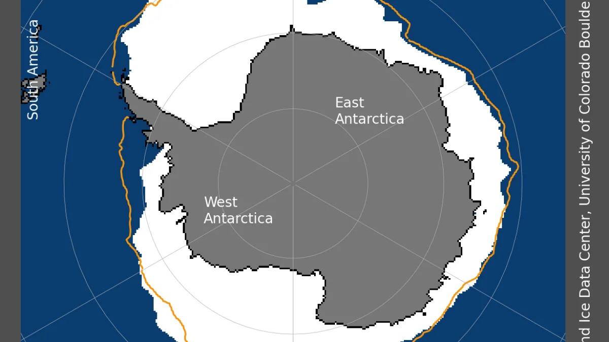
Antarctic sea ice extent began a sustained decline around 2015, reaching a post-1970s minimum in 2023. Research from the British Antarctic Survey and collaborators describes a compound process: intensifying westerly winds precondition the Southern Ocean by upwelling warm, saline circumpolar deep water; strong wind events then mix that water upward; reduced export of freshwater from melting ice helps lock in a persistently low state. East Antarctic losses were driven mainly by subsurface heat, while West Antarctic losses also responded to longwave radiative anomalies.
Copernicus Climate Change Service reports for early 2026 already flagged the Bellingshausen as a standout below-average sector while other regions, such as the Weddell Sea, saw mixed or above-average cover. Mid-June satellite imagery shows the same west-coast deficit persisting as winter progresses.
What happens next
Scientists will monitor whether any ice re-forms in the Bellingshausen through August and September, and continue linking ocean temperature profiles to satellite extent. Cordero warned that without a sharp reduction in global greenhouse gas emissions, events like the June 2026 heat spike will occur with increasing frequency. The episode also unfolded against a backdrop of globally elevated temperatures — May 2026 ranked among the warmest Mays on record worldwide.
For Argentina, which operates Esperanza, Marambio and San Martín, the rain-on-snow conditions are an operational as well as a scientific concern. For the wider world, the story is a reminder that polar change is measured not only in summer headlines but in winter ice that never arrives.
Track global temperatures on SatMeteo
As Antarctic winter heat and sea-ice deficits unfold alongside broader climate shifts, near-real-time temperature patterns help put regional extremes in context. Check forecasts for Buenos Aires, the mainland gateway for Argentina’s Antarctic programme, and use the live temperature map on SatMeteo to monitor heat building across the Southern Hemisphere and worldwide.